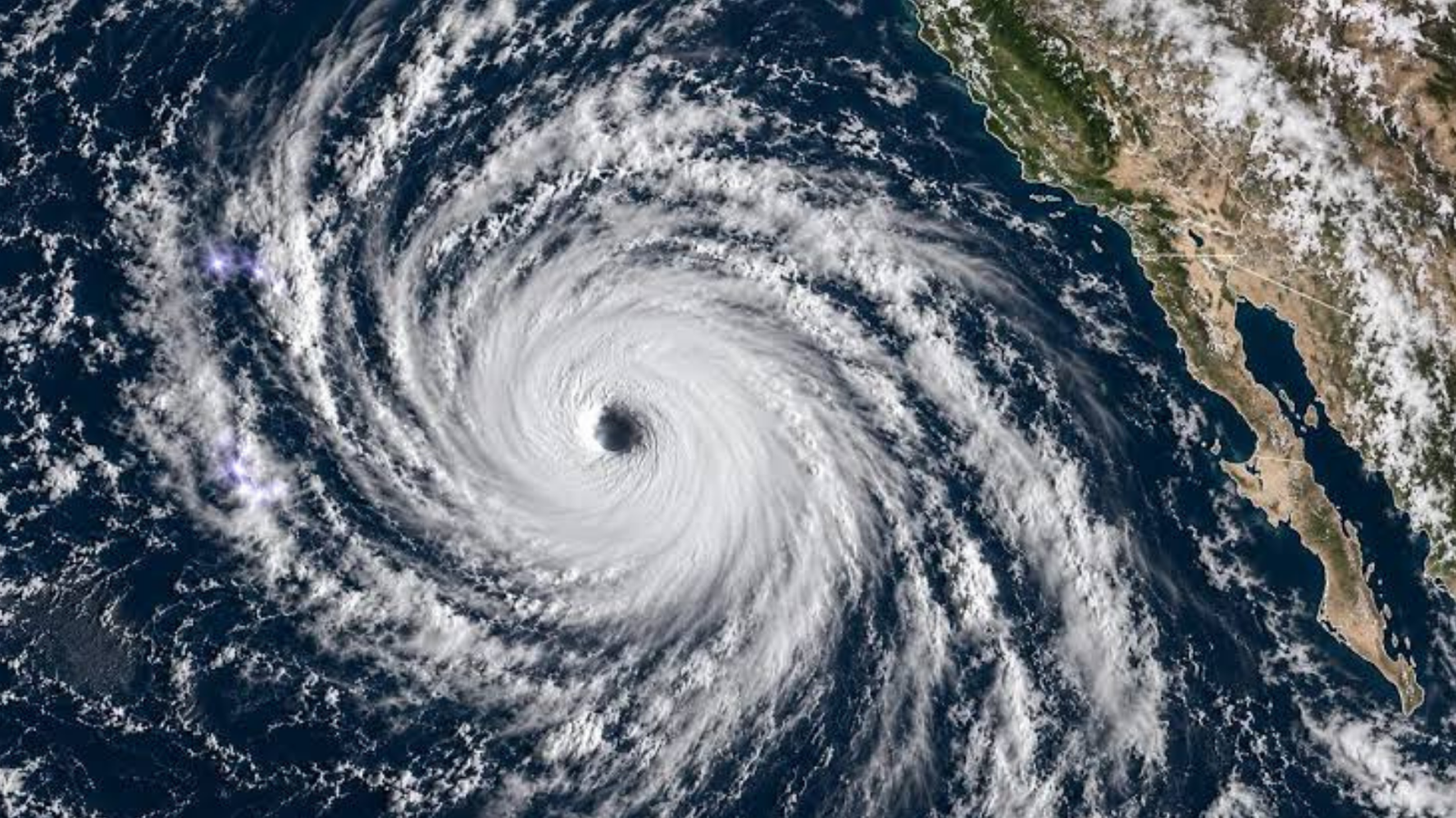
Hurricane Polo has rapidly intensified into one of the strongest storms of the Pacific hurricane season, with forecasters warning of dangerous conditions along Mexico’s southwestern coastline despite expectations that the storm will remain offshore.
A Hurricane Hunter aircraft operated by the US National Oceanic and Atmospheric Administration (NOAA) recorded sustained winds of nearly 180 mph (285 km/h) on Tuesday, with even stronger gusts reported within the storm. The National Hurricane Center described Polo as an “extremely dangerous” hurricane and said its rapid strengthening over a 24-hour period was “truly remarkable.”
Polo has now become the Pacific season’s third Category 5 hurricane, the highest classification on the Saffir-Simpson Hurricane Wind Scale. Meteorologists say the storm has been fueled by exceptionally warm ocean temperatures associated with the El Niño climate pattern, creating ideal conditions for further intensification.
Although current forecasts indicate the hurricane is unlikely to make direct landfall, it is expected to track northwestward parallel to Mexico’s Pacific coast over the coming days. Forecasters warn that the storm’s proximity to the shoreline could still bring significant impacts to several coastal regions.
Heavy rainfall is forecast across parts of southwestern Mexico, raising concerns about flash flooding, river overflow, and potentially deadly mudslides. Some areas could receive up to 6 inches (15 centimeters) of rain, with isolated locations potentially recording as much as 8 inches.
Authorities have also warned of dangerous ocean conditions, including large swells, rough surf, and powerful rip currents that could pose risks to coastal communities and beachgoers.
Mexican President Claudia Sheinbaum said initial assessments indicate the storm is not expected to make a direct strike on the coastline. However, she urged residents to remain vigilant and follow emergency instructions as weather conditions could change.
The states of Jalisco, Colima, and Michoacán have been identified as areas potentially vulnerable to the storm’s impacts, particularly from heavy rain and hazardous coastal conditions.
Data collected by reconnaissance aircraft suggests Polo could maintain its Category 5 strength for several days. Meteorologists attribute the storm’s resilience to exceptionally warm sea surface temperatures and favorable atmospheric conditions across the eastern Pacific.
Emergency management officials continue to monitor the hurricane closely as preparations remain underway across affected coastal regions.









+ There are no comments
Add yours