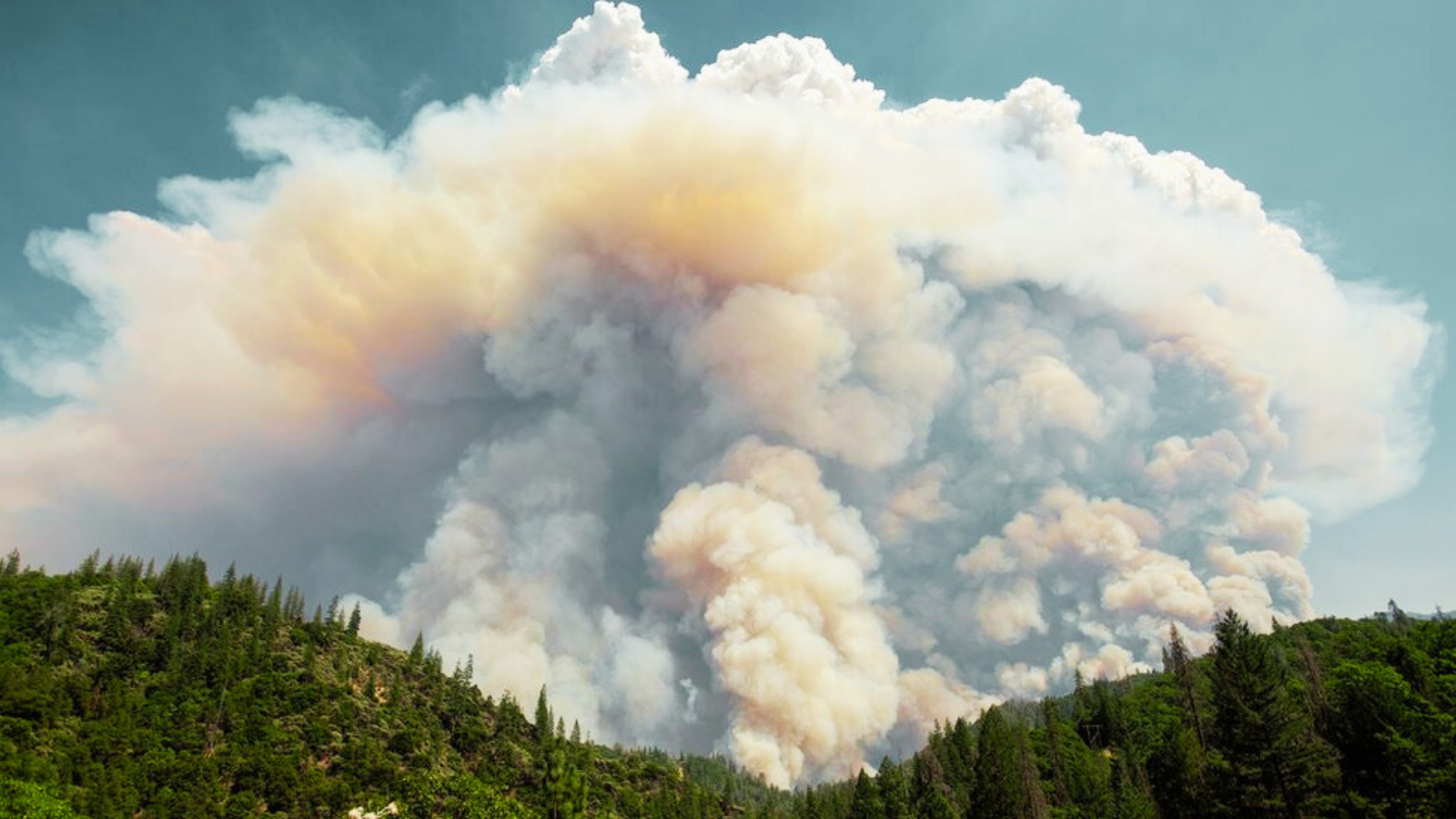
The bushfire burning in north‑east Victoria near Walwa intensified so dramatically this afternoon that it generated its own weather system, producing a large pyrocumulonimbus (pyroCb) cloud complete with lightning and thunder.
Pyrocumulonimbus clouds often described as fire‑generated thunderstorms are among the most dangerous forms of bushfire behaviour. They occur during extreme fire conditions when heat, smoke, and atmospheric instability combine to create towering storm clouds capable of producing lightning, strong winds, and unpredictable fire spread.
How Fire‑Generated Thunderstorms Form
These clouds develop when the intense heat from a bushfire forces air to rise rapidly through the smoke plume.
As the hot, turbulent air rises, it draws in cooler surrounding air, helping the plume expand upward.
Once the plume reaches high enough into the atmosphere, low pressure causes the air to cool, allowing moisture to condense and form a cloud similar to a typical thunderstorm.
In an unstable atmosphere, this process can escalate into a full pyrocumulonimbus cloud, which may then produce lightning strikes, further igniting new fires.
“The Landscape Is Fully Flammable” Expert Warning
University of New South Wales bushfire scientist Rick McRae, a leading researcher on pyroCb events, said the formation of such a cloud indicates extreme dryness and a landscape primed to burn.
“I saw yesterday that the river flow in the Albury area is drying out catastrophically,” he said.
“That says there’s no water in the landscape. And that means all the burnable biomass is fully flammable. A large log lying on the ground will turn to white ash in two hours.”
McRae warned that such conditions add enormous extra heat to the fire, increasing its intensity and unpredictability.
Authorities continue to monitor the Walwa fire closely as conditions remain volatile.


+ There are no comments
Add yours