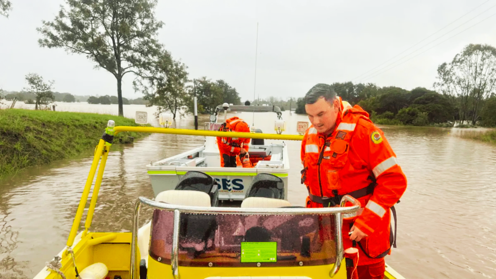
Emergency crews across New South Wales are bracing for more chaos as relentless rain lashes the state, with floodwaters already triggering multiple rescues. Torrents have inundated regions still reeling from recent floods, prompting urgent warnings from the NSW State Emergency Service (SES).
On Thursday morning, SES teams pulled a man to safety from a van stranded in rising waters near Douglas Park, southwest of Sydney. It was one of four rescues that day, with similar emergencies unfolding in St Albans, Albion Park, and Ourimbah.
“This is exactly the kind of situation we urge people to avoid,” said SES spokesman Andrew McCullough. “We’re prepared, but driving into floodwater puts lives at risk.”
The Mid North Coast bore the brunt of the deluge, with rainfall totals topping 140mm in places like Port Macquarie Airport and Lake Cathie. Green Valley and Telegraph Point also saw triple-digit downpours.
Forecasters say the extreme weather is the result of a rare convergence of three systems:
- A high-pressure system over the southern Tasman Sea is funneling moist winds toward the coast
- A coastal trough is lifting that moisture into the atmosphere
- An upper-level low over inland NSW is intensifying the effect
With more rain forecast and saturated catchments primed for flooding, authorities are urging residents to stay informed and avoid unnecessary travel. The skies may be grey, but vigilance could be the difference between safety and disaster.


+ There are no comments
Add yours